 VR-TheWorld Server
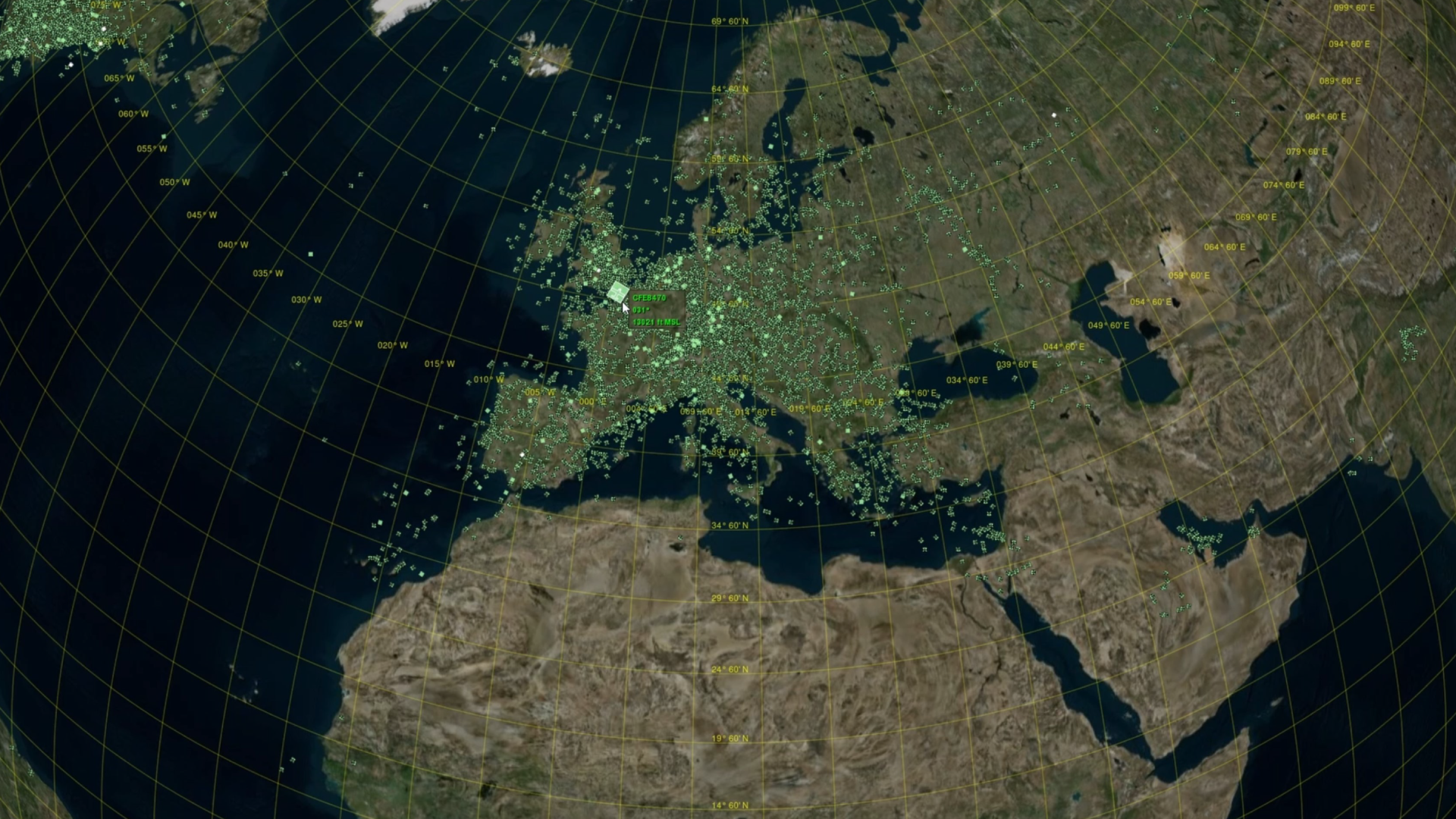
The physical world within MAK ONE Synthetic Environments
Streaming Terrain for MAK ONE applications and standards compatible simulations
VR-TheWorld Server stores and streams the terrain data used to build MAK ONE Synthetic Environments. Elevation, imagery, and features including roads, buildings, and trees can be streamed to multiple applications simultaneously.
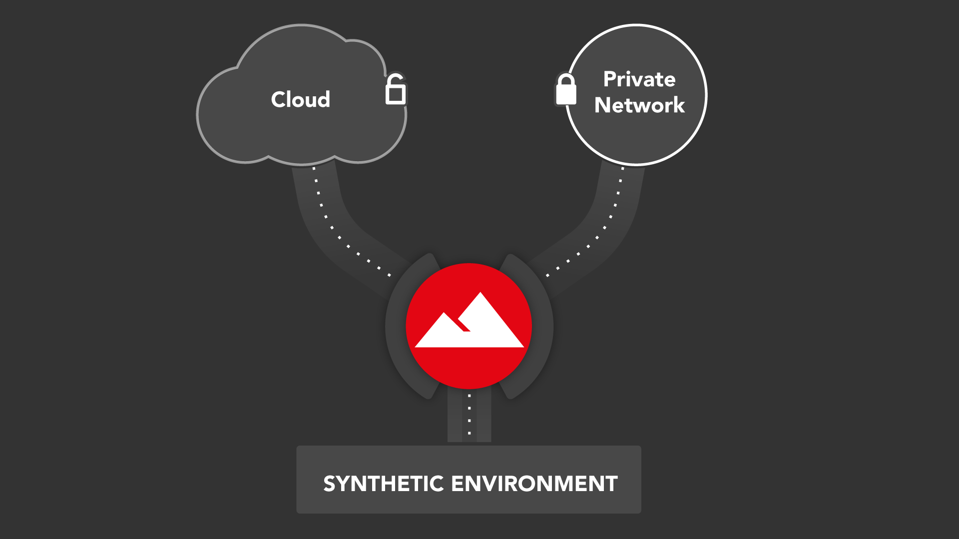
MAK’s VR-TheWorld Server is a flexible terrain server that can respond to run-time queries from simulation and visualization applications, by providing tiled raster and feature data in standard source formats. MAK One applications (VR-Forces, VR-Engage, and VR-Vantage) can immediately connect to VR-TheWorld Server through several of its default terrain configurations. 3rd party applications can also stream data from VR-TheWorld Server if they support the relevant open-standard protocols.
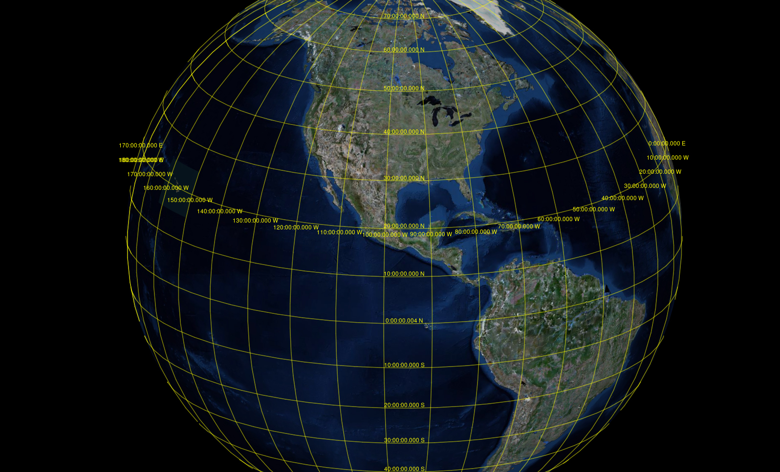
VR-TheWorld Server Base Globe and Sample Data
VR-TheWorld Server comes pre-loaded with over three terabytes of elevation, imagery, land cover data, feature data and more — pre-tiled for high performance access. Users can also add their own datasets to augment or replace the pre-loaded data on their own local copies of VR-TheWorld Server.
The VR-TheWorld Base Globe includes the following worldwide data:
- Elevation: 30-meter (DTED Level 2) for the entire globe, based on NASA’s SRTM V3 (SRTM Plus) dataset, merged with SRTM30Plus bathymetry; augmented with 25-meter EU-DEM data for all of Europe, and 22-meter CDEM data for Canada.
- Imagery: 15-meter cloud-free imagery for the entire globe’s landmass, based on the Landsat 7 dataset, merged with NASA Blue Marble (500-meter) data for the oceans, all color-corrected for seamless display.
- Land Cover: 100-meter resolution for the entire globe’s landmass, based on the ESA Copernicus Global Land Cover dataset; augmented with 30-meter US National Land Cover Database (NLCD) for the continental US.
- Feature Data: The complete global OpenStreetMap dataset of roads, water, building footprints, land use features, and point features such as lights, radio towers, and much more; converted to MBTiles format for faster run-time access. Global airport database from X-Plane, converted to standard shapefiles, including geo-specific runway data, airport boundaries, lights, windsocks, NAVAIDs, taxiways, signs and more for the world’s 30,000 airfields.
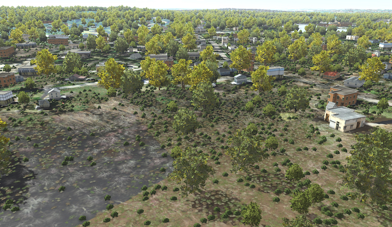
VR-TheWorld Server’s built-in dataset also includes a number of higher-resolution raster and feature layers for select local insets:
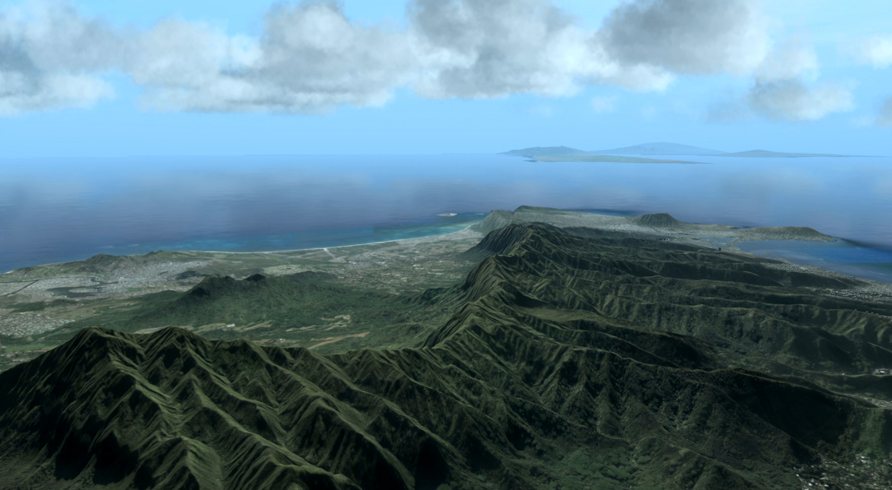
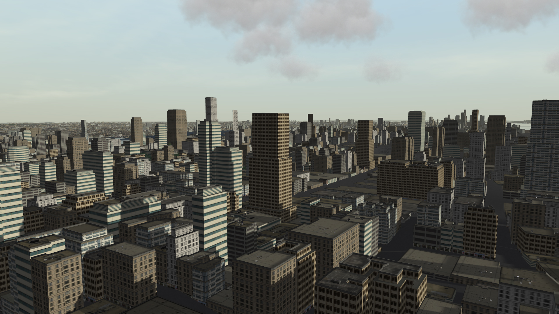
- High-resolution imagery inset areas ranging from 1m down to 15cm per pixel – including Boston, Hawaii, Seattle, Guam, Miami, all of Switzerland; and all of California, which includes the US Army National Training Center at Fort Irwin, as well as US Marine Corps ranges at Twentynine Palms and Camp Pendleton. Data sources include USGS NAIP Plus, as well as local datasets.
- High-detail elevation inset areas ranging from 10m down to 1m – for Hawaii, Guam, Miami, and large areas of Southern California. Data sources include the USGS Digital Elevation Model, as well as local datasets.
- Enhanced bathymetry data at 10m resolution for all coastal areas of the US, based on NOAA’s Tsunami Inundation Dataset.
- Enhanced Land Cover data at 15m resolution for all of California, based on the CALFIRE-FRAP dataset; and 2.5m Land Cover for Hawaii and Guam based on the NOAA Coastal Change Analysis (C-CAP) dataset.
- High-resolution feature data for Oahu (building footprints for 230,000 buildings), Los Angeles county (3 million buildings), as well as for several US Army and Marine Corps training ranges; and sample S-57 nautical feature data for southern California, Hawaii, and Massachusetts.
- Raster maps and charts: Samples of digitized maps, topographic maps, Instrument Flight Rules (IFR) Enroute High and Low Altitude Charts, and Raster Nautical Charts (RNC) for the US.
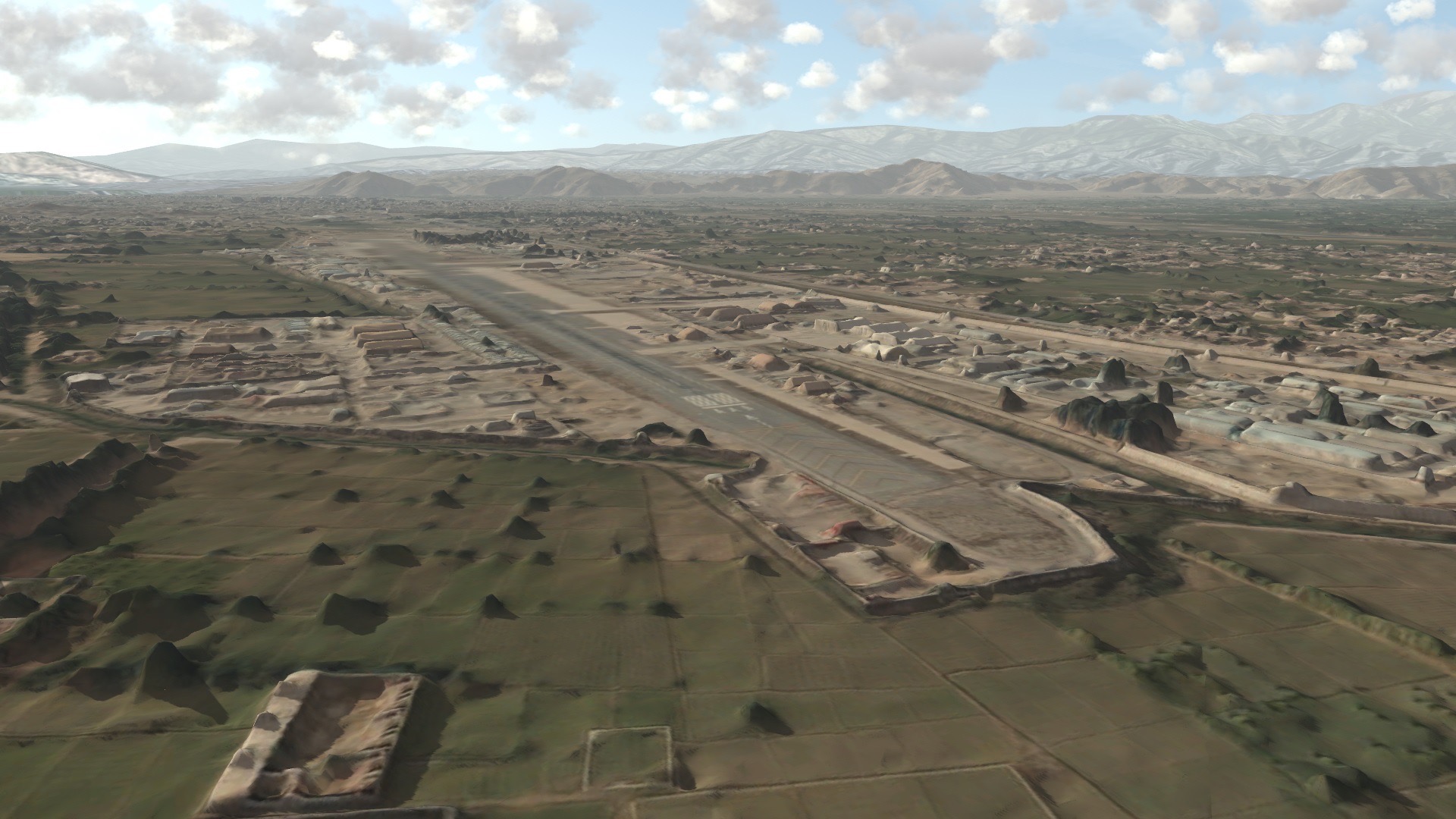
3DTiles / glTF Sample
VR-TheWorld Server also provides a sample terrain database of Jalalabad, Afghanistan in the 3DTiles / glTF format.
- This new format is the basis for the US Army STE One World Terrain format and is gaining momentum by global data producers such as MAXAR and Google.
- The included sample is provided not as an example of the best format for all M&S applications, but rather to demonstrate MAK's commitment to emerging data formats.
Learn More
Key Features
Ready Out-of-the-Box
A VR-TheWorld server is a fully standalone version of VR-TheWorld and can be deployed behind firewalls and security barriers.
Available Online
MAK hosts a copy of VR-TheWorld Server online for MAK ONE users to use in prototyping solutions and developing capability demonstrations.
Terabytes of Data
VR-TheWorld has over three terabytes of global elevation, imagery, and feature data — pre-tiled for high performance access.
Automatic Tiling for Performance
Large data files are automatically tiled on the server so that they can be streamed efficiently to client applications.
Add Your Own Data
VR-TheWorld Server comes with an intuitive web interface that makes uploading and organizing your data simple.
Raster Formats
The following raster data formats are supported for elevation and imagery:
MRSID, GDAL virtual, Geotiff, JPEG 2000, DEM, DTED 0 - 5, Arcinfo Binary Grid, Magellan BLX Topo, Bathymetry Attributed Grid, VTP Binary terrain format, USGS DOQ, ESRI .hdr, Envisat Image Product, ERMapper, FITS, Erdas Imagine, National Imagery Transport Files (CIB, CADRG, and so on), BSB Nautical chart format, NetCDF
Vector Formats
The following vector data formats are supported for natural and human-made features:
ESRI Shape, KML, GPX, VMAP, S-57
Resources for Customers
Sign up to access these resources